
UN General Assembly Endorses Equal Earth Projection to Replace Mercator Map
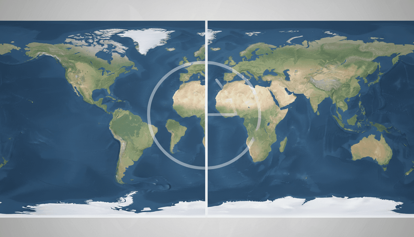
Here's what it means for you.
Your understanding of global geography may shift as educational materials and media representations adapt to more accurate map projections.
Why it matters
This resolution addresses historical distortions in global perceptions, particularly regarding Africa's size and significance.
What happened (in 30 seconds)
- On September 4, 2026, the UN General Assembly adopted the 'Correct the Map' resolution endorsing the Equal Earth projection.
- Supported by 164 member states, the resolution aims to replace the Mercator projection, which distorts landmass sizes.
- The United States was the only opposing vote, with France and the UK supporting the shift towards more accurate representations.
The context you actually need
- The Mercator projection, created in 1569, exaggerates polar regions and minimizes equatorial ones, leading to misconceptions about landmass sizes.
- Africa is approximately 14 times larger than Greenland, yet the Mercator map presents them as comparable, affecting education and media narratives.
- The Equal Earth projection, developed in 2018, aims to preserve equal areas while reducing shape distortions, addressing criticisms of traditional mapping.
What's really happening
The adoption of the Equal Earth projection by the UN is a significant step in addressing long-standing criticisms of the Mercator map, which has dominated cartography for centuries. The Mercator projection, designed for maritime navigation, preserves angles but distorts the size of landmasses, particularly those near the equator. This distortion has led to a skewed understanding of global geography, where regions like Africa are perceived as much smaller than they are in reality.
The resolution, sponsored by Togo on behalf of the African Union, reflects a growing recognition of the need for cognitive justice in cartography. By endorsing the Equal Earth projection, the UN is not just advocating for a more accurate representation of the world but also challenging the historical narratives that have marginalized equatorial regions. The resolution encourages educational institutions and governments to update their maps and materials, promoting a more equitable understanding of global geography.
The implications of this shift are profound. As educational materials in places like Dubai begin to reflect the Equal Earth projection, students and residents will gain a more accurate perspective on the world. This could influence perceptions of resource distribution, geopolitical significance, and cultural narratives surrounding different regions.
Moreover, the resolution's non-binding nature means that while it encourages voluntary adoption, the actual implementation will vary by country and institution. France's commitment to abandon the Mercator projection in favor of more accurate alternatives signals a potential trend among other nations. However, the U.S. opposition highlights the ideological divides that can complicate global consensus on such issues.
In the long term, the resolution may lead to changes in cartography software, textbooks, and international organizations' mapping practices. As more countries and institutions adopt the Equal Earth projection, the narrative around global geography will continue to evolve, potentially reshaping how we view and interact with the world.
Who feels it first (and how)
- Educational institutions: Will need to update curricula and materials to reflect the new projection.
- Media organizations: May alter visual representations of maps in news coverage and publications.
- Geographers and cartographers: Will adapt their practices and tools to align with the new standards.
- Students and residents in Dubai: Will experience a shift in their understanding of global geography and resource distribution.
What to watch next
- Adoption rates of the Equal Earth projection: Monitoring how quickly educational institutions and governments implement the new projection will indicate its acceptance.
- Changes in cartography software: Look for updates from major mapping software providers to see if they incorporate the Equal Earth projection.
- International responses: Watch for how other nations react to the U.S. opposition and whether they follow France's lead in abandoning the Mercator projection.
The UN General Assembly adopted the resolution with overwhelming support.
Educational materials and media representations will gradually shift to reflect the Equal Earth projection.
The long-term impact on geopolitical perceptions and resource distribution narratives remains to be seen.
Frequently Asked Questions
- Why it matters?
- This resolution addresses historical distortions in global perceptions, particularly regarding Africa's size and significance.
- What happened (in 30 seconds)?
- On September 4, 2026, the UN General Assembly adopted the 'Correct the Map' resolution endorsing the Equal Earth projection. Supported by 164 member states, the resolution aims to replace the Mercator projection, which distorts landmass sizes. The United States was the only opposing vote, with France and the UK supporting the shift towards more accurate representations.
- What's really happening?
- The adoption of the Equal Earth projection by the UN is a significant step in addressing long-standing criticisms of the Mercator map, which has dominated cartography for centuries. The Mercator projection, designed for maritime navigation, preserves angles but distorts the size of landmasses, particularly those near the equator. This distortion has led to a skewed understanding of global geography, where regions like Africa are perceived as much smaller than they are in reality. The resolutio
- Who feels it first (and how)?
- Educational institutions: Will need to update curricula and materials to reflect the new projection. Media organizations: May alter visual representations of maps in news coverage and publications. Geographers and cartographers: Will adapt their practices and tools to align with the new standards. Students and residents in Dubai: Will experience a shift in their understanding of global geography and resource distribution.
- What to watch next?
- Adoption rates of the Equal Earth projection: Monitoring how quickly educational institutions and governments implement the new projection will indicate its acceptance. Changes in cartography software: Look for updates from major mapping software providers to see if they incorporate the Equal Earth projection. International responses: Watch for how other nations react to the U.S. opposition and whether they follow France's lead in abandoning the Mercator projection.
Arabic-language reporting on global and regional news.
"BBC Arabic is part of the BBC, generally regarded for editorial standards and broad international coverage."
— A47 Editor
لماذا غيّرت الأمم المتحدة خريطة العالم؟ وأي الخرائط أدقّ؟
The United Nations has adopted a new world map that accurately reflects the true size of Africa, highlighting the importance of geographical representation. This change aims to address longstanding inaccuracies in global mapping that have often minim...
Arabic-language political and world news coverage for UAE readers.
"Emarat Al Youm world coverage usually presents international developments through a UAE and Arab audience lens."
— A47 Editor
الأمم المتحدة تعتمد بالأغلبية قراراً لتعديل خريطة العالم الأمم المتحدة تعتمد بالأغلبية قراراً لتعديل خريطة العالم
The United Nations General Assembly approved a resolution on Friday aimed at improving global mapping to better reflect the true size of countries. This decision is part of ongoing efforts to enhance geographical accuracy and representation in intern...
Jordanian news and regional updates.
"Roya News is a Jordanian outlet focused on breaking news and local affairs."
— A47 Editor
الأمم المتحدة تصوت لصالح خريطة عالمية جديدة وواشنطن المعارض الوحيد
The United Nations General Assembly voted on Friday to adopt a new global map, with Washington being the only opposing voice. This decision reflects a significant shift in international consensus regarding territorial delineations and geopolitical re...