
Hurricane Polo Intensifies to Category 5 Off Mexican Coast with Flooding Risks
Why it matters
Hurricane Polo exemplifies the increasing intensity of Pacific cyclones, which can disrupt trade and heighten insurance costs globally.
What happened (in 30 seconds)
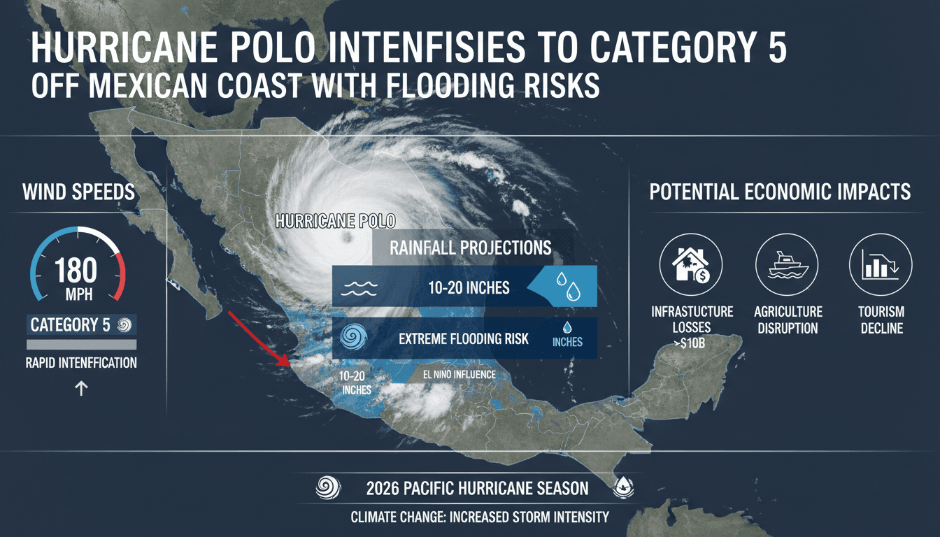
- Hurricane Polo formed on September 20, 2026, rapidly intensifying to a Category 5 storm with peak winds of 180 mph.
- The storm is currently a Category 4 hurricane, moving parallel to the Mexican coast, threatening heavy rainfall and dangerous surf.
- Mexican authorities have issued warnings for coastal states, preparing for potential flooding and mudslides without a direct landfall.
The context you actually need
- The 2026 Pacific hurricane season has seen multiple intense storms, with Polo being one of the most powerful, influenced by warm sea surface temperatures and possibly El Niño conditions.
- Hurricane Polo's rapid intensification ties records for Eastern Pacific hurricanes, highlighting the growing unpredictability of storm patterns.
- Mexico's preparedness has improved since Hurricane Otis in 2023, which set a precedent for proactive measures against cyclones.
What's really happening
Hurricane Polo's formation and intensification are emblematic of a broader trend in climate patterns, particularly in the Pacific Ocean. The storm developed in an environment ripe for rapid intensification, characterized by unusually warm sea surface temperatures. These conditions are often exacerbated by phenomena like El Niño, which can lead to more severe weather events.
As Polo intensified, it reached peak winds of 180 mph, making it the second-most intense Eastern Pacific hurricane by pressure and tying for the third-strongest by wind speed. This rapid escalation in intensity is not just a meteorological anomaly; it reflects a systemic shift in how hurricanes behave due to climate change. The increasing frequency and intensity of such storms can lead to significant economic repercussions, particularly for coastal regions that are often ill-prepared for such events.
Despite Polo's current trajectory, which keeps it offshore, the storm is still expected to generate substantial rainfall—between 4 to 8 inches—and dangerous surf conditions. This poses a risk of life-threatening flash floods and mudslides in states like Guerrero, Michoacán, Colima, and Jalisco. The Mexican government has taken precautionary measures, issuing warnings and preparing coastal areas for potential impacts, even in the absence of a direct landfall.
The implications of Hurricane Polo extend beyond immediate weather concerns. The storm's intensity and the potential for flooding can disrupt local economies, particularly in tourism and agriculture, which are vital to these coastal states. Additionally, the insurance industry may face increased claims and higher premiums as the frequency of such storms rises, affecting consumers and businesses alike.
Who feels it first (and how)
- Coastal residents in Guerrero, Michoacán, Colima, and Jalisco face immediate risks from flooding and mudslides.
- Local businesses in tourism and agriculture may experience disruptions and financial losses due to storm impacts.
- Insurance companies could see increased claims and higher premiums as a result of intensified storm activity.
What to watch next
- Rainfall totals: Monitoring the actual rainfall amounts will indicate the severity of flooding and potential economic impacts.
- Insurance claims: The volume of claims filed post-storm will provide insight into the financial repercussions for businesses and homeowners.
- Future storm patterns: Observing the 2026 Pacific hurricane season's developments will help assess long-term trends in storm intensity and frequency.
Hurricane Polo has reached Category 4 status and is currently moving parallel to the Mexican coast.
The storm will generate significant rainfall and surf, leading to flooding and mudslide risks in coastal areas.
The long-term economic impacts on local businesses and the insurance market remain to be fully assessed.
Frequently Asked Questions
- Why it matters?
- Hurricane Polo exemplifies the increasing intensity of Pacific cyclones, which can disrupt trade and heighten insurance costs globally.
- What happened (in 30 seconds)?
- Hurricane Polo formed on September 20, 2026, rapidly intensifying to a Category 5 storm with peak winds of 180 mph. The storm is currently a Category 4 hurricane, moving parallel to the Mexican coast, threatening heavy rainfall and dangerous surf. Mexican authorities have issued warnings for coastal states, preparing for potential flooding and mudslides without a direct landfall.
- What's really happening?
- Hurricane Polo's formation and intensification are emblematic of a broader trend in climate patterns, particularly in the Pacific Ocean. The storm developed in an environment ripe for rapid intensification, characterized by unusually warm sea surface temperatures. These conditions are often exacerbated by phenomena like El Niño, which can lead to more severe weather events. As Polo intensified, it reached peak winds of 180 mph, making it the second-most intense Eastern Pacific hurricane by pre
- Who feels it first (and how)?
- Coastal residents in Guerrero, Michoacán, Colima, and Jalisco face immediate risks from flooding and mudslides. Local businesses in tourism and agriculture may experience disruptions and financial losses due to storm impacts. Insurance companies could see increased claims and higher premiums as a result of intensified storm activity.
- What to watch next?
- Rainfall totals: Monitoring the actual rainfall amounts will indicate the severity of flooding and potential economic impacts. Insurance claims: The volume of claims filed post-storm will provide insight into the financial repercussions for businesses and homeowners. Future storm patterns: Observing the 2026 Pacific hurricane season's developments will help assess long-term trends in storm intensity and frequency.
International news, politics, and culture.
"Sky News is a UK-based 24-hour channel known for fast-breaking news and political coverage."
— A47 Editor
Hurricane Polo brings heavy rain to Mexican coast with fears of life-threatening floods
Hurricane Polo has rapidly intensified into a Category 5 storm, bringing heavy rain and raising fears of life-threatening floods along Mexico's Pacific coast. The storm, with sustained winds of 165 mph, is currently located approximately 215 miles so...
Comprehensive coverage of global events, politics, and international issues.
"NBC News is a mainstream outlet known for comprehensive national and international coverage with a centrist to slightly left-leaning editorial tone."
— A47 Editor
Hurricane Polo fuels fears of heavy rain and landslides in Mexico’s southwest
Hurricane Polo has rapidly intensified into a Category 5 storm, with sustained winds reaching 165 mph, as it approaches the southwestern coast of Mexico, raising fears of heavy rainfall and mudslides in the region. The Mexican government has suspende...
Scientific discoveries, health, technology, and natural phenomena.
"Live Science reports on scientific discoveries, health, technology, and natural phenomena with a popular science tone."
— A47 Editor
Hurricane Polo exploded in intensity in just 24 hours. Is the 'super' El Niño to blame?
Hurricane Polo rapidly intensified from a tropical storm to a Category 5 hurricane within 24 hours, marking it as one of the strongest Pacific hurricanes recorded. This explosive growth has raised questions about the influence of the current 'super' ...
Reports on climate change, environmental science, sustainability, and nature.
"BBC News is widely regarded as a reputable international news organization, known for its impartial tone and public service mandate."
— A47 Editor
Did El Niño turn Hurricane Polo into the most powerful storm of the season?
El Niño has rapidly intensified Hurricane Polo, potentially making it one of the most powerful storms of the Pacific season, as reported by BBC's Courtney Sargent. The phenomenon has been linked to warmer ocean temperatures and altered atmospheric co...
News across North, Central, and South America including politics and economics.
"France 24 is viewed as a globally focused outlet with balanced coverage and a European perspective."
— A47 Editor
Hurricane Polo churns off Mexico
Hurricane Polo has rapidly intensified into a Category 5 storm, with maximum sustained winds of 165 miles per hour, as it churns approximately 215 miles south of Zihuatanejo, Mexico. The National Hurricane Center has labeled Polo as an “extremely dan...
International coverage from The Guardian's global desks.
"The Guardian is known for its progressive editorial stance and in-depth analysis."
— A47 Editor
Hurricane Polo, rapidly intensifying from strong El Niño patterns, rages off coast of Mexico
Hurricane Polo has rapidly intensified into a Category 5 storm, with sustained winds of 165 mph, as it churns approximately 215 miles south of Zihuatanejo, Mexico. This intensification is attributed to strong El Niño patterns in the Pacific Ocean. De...
Global coverage of politics, crises, and international affairs.
"HuffPost provides progressive-oriented reporting on international developments, often focusing on humanitarian and social justice issues."
— A47 Editor
Hurricane Polo Churns Off Mexico's Pacific Coast As 'One Of The Strongest Storms Ever'
Hurricane Polo has rapidly intensified into a Category 5 storm, with sustained winds reaching 165 mph, as it churns approximately 215 miles south of Zihuatanejo, Mexico. The Mexican government has temporarily suspended classes along the Pacific Coast...