
Hurricane Polo Rapidly Intensifies to Category 5 in Eastern Pacific
Why it matters
The rapid intensification of hurricanes like Polo signals a concerning trend linked to climate change, affecting coastal economies and disaster preparedness.
What happened (in 30 seconds)
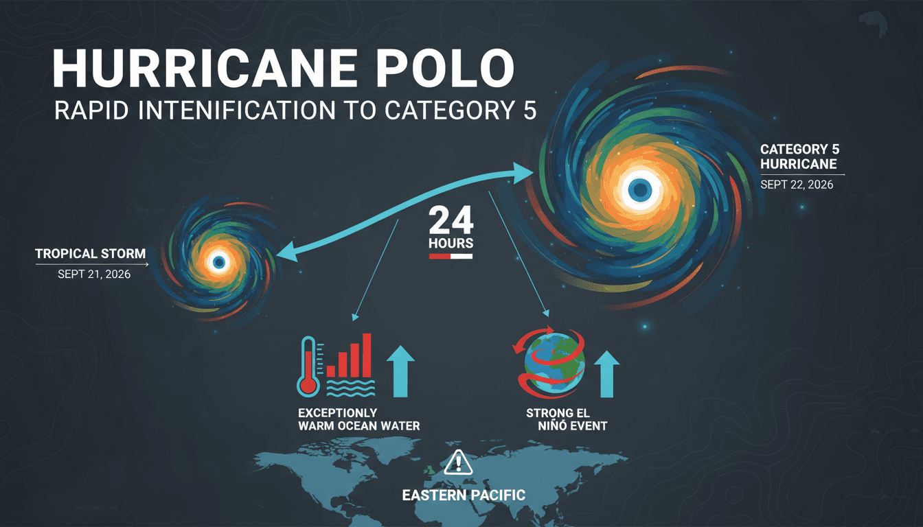
- Hurricane Polo intensified from a tropical storm to a Category 5 hurricane in under 24 hours, reaching peak winds of 180 mph.
- El Niño conditions and warm ocean temperatures contributed to this explosive growth, with sea surface temperatures near 31°C.
- Current status: Polo has weakened to a Category 4 hurricane and is drifting northwest, posing risks of heavy rainfall and flooding along Mexico's Pacific coast.
The context you actually need
- El Niño's role: The 2026 Pacific hurricane season is characterized by a strong El Niño, which has led to record sea surface temperature anomalies, creating favorable conditions for tropical cyclones.
- Historical perspective: This rapid intensification is one of the fastest recorded in the Eastern Pacific, with a 110 mph increase in maximum sustained winds within 24 hours.
- Geographical focus: While Hurricane Polo remains offshore, its impacts are felt through heightened rainfall and flooding risks along the Mexican coast, emphasizing the need for preparedness.
What's really happening
Hurricane Polo's rapid intensification is a stark reminder of the changing dynamics of tropical cyclones, driven by a combination of environmental factors. The storm formed as Tropical Depression Seventeen-E on September 20, 2026, and quickly escalated due to exceptionally warm ocean conditions, with sea surface temperatures reaching 31°C (88°F). This warmth, coupled with low wind shear and abundant moisture, created an ideal environment for rapid strengthening.
The influence of El Niño cannot be overstated. This climate pattern, characterized by warmer ocean temperatures in the central and eastern Pacific, has been linked to increased hurricane activity in the region. In 2026, the El Niño event was particularly strong, with sea surface temperature anomalies exceeding 3°C, setting the stage for enhanced tropical cyclone development. As a result, disturbances organized south of Mexico, leading to the formation of Polo amid conditions that were ripe for explosive growth.
The National Hurricane Center (NHC) and NOAA Hurricane Hunters monitored the storm closely, confirming its peak intensity with a central pressure of 892 mb. The rapid transition from a tropical storm to a Category 5 hurricane in less than 24 hours is indicative of the changing nature of these storms, which are becoming more unpredictable and intense due to climate change.
As Polo drifts northwest, it has weakened to a Category 4 hurricane, but the risks remain significant. Mexican authorities have issued warnings for heavy rainfall, life-threatening flooding, and mudslides along the Pacific coast, even though direct landfall is not expected. The storm's trajectory and intensity underscore the importance of preparedness and response strategies in coastal regions, particularly as climate change continues to influence weather patterns.
The implications of such rapid intensification extend beyond immediate weather impacts. They raise questions about infrastructure resilience, insurance costs, and the economic stability of regions prone to hurricanes. As storms like Polo become more frequent and intense, the need for adaptive strategies in urban planning, disaster response, and climate policy becomes increasingly urgent.
Who feels it first (and how)
- Coastal residents: Those living along Mexico's Pacific coast face immediate risks from flooding and mudslides.
- Insurance companies: Increased hurricane intensity may lead to higher claims and premiums, affecting policyholders.
- Supply chain managers: Disruptions in coastal areas can impact shipping routes and logistics, affecting global trade.
What to watch next
- Hurricane tracking updates: Monitor the NHC for real-time updates on Polo's trajectory and intensity, which could influence coastal preparedness.
- El Niño developments: Watch for changes in El Niño conditions, as they can affect hurricane activity in the Pacific and Atlantic basins.
- Economic impacts: Keep an eye on insurance market responses and potential shifts in coastal infrastructure investments as a result of increased hurricane risks.
Hurricane Polo rapidly intensified due to warm ocean conditions and El Niño.
Increased hurricane activity will continue as climate change impacts weather patterns.
The long-term economic implications for coastal regions and insurance markets remain to be fully assessed.
Frequently Asked Questions
- Why it matters?
- The rapid intensification of hurricanes like Polo signals a concerning trend linked to climate change, affecting coastal economies and disaster preparedness.
- What happened (in 30 seconds)?
- Hurricane Polo intensified from a tropical storm to a Category 5 hurricane in under 24 hours, reaching peak winds of 180 mph. El Niño conditions and warm ocean temperatures contributed to this explosive growth, with sea surface temperatures near 31°C. Current status: Polo has weakened to a Category 4 hurricane and is drifting northwest, posing risks of heavy rainfall and flooding along Mexico's Pacific coast.
- What's really happening?
- Hurricane Polo's rapid intensification is a stark reminder of the changing dynamics of tropical cyclones, driven by a combination of environmental factors. The storm formed as Tropical Depression Seventeen-E on September 20, 2026, and quickly escalated due to exceptionally warm ocean conditions, with sea surface temperatures reaching 31°C (88°F). This warmth, coupled with low wind shear and abundant moisture, created an ideal environment for rapid strengthening. The influence of El Niño cannot
- Who feels it first (and how)?
- Coastal residents: Those living along Mexico's Pacific coast face immediate risks from flooding and mudslides. Insurance companies: Increased hurricane intensity may lead to higher claims and premiums, affecting policyholders. Supply chain managers: Disruptions in coastal areas can impact shipping routes and logistics, affecting global trade.
- What to watch next?
- Hurricane tracking updates: Monitor the NHC for real-time updates on Polo's trajectory and intensity, which could influence coastal preparedness. El Niño developments: Watch for changes in El Niño conditions, as they can affect hurricane activity in the Pacific and Atlantic basins. Economic impacts: Keep an eye on insurance market responses and potential shifts in coastal infrastructure investments as a result of increased hurricane risks.
Scientific discoveries, health, technology, and natural phenomena.
"Live Science reports on scientific discoveries, health, technology, and natural phenomena with a popular science tone."
— A47 Editor
How did Hurricane Polo get so powerful?
Hurricane Polo rapidly intensified from a tropical storm to a powerful Category 5 hurricane within 24 hours, marking a significant escalation in its strength. This rapid transformation occurred on Tuesday, raising concerns about the potential impact ...
News across North, Central, and South America including politics and economics.
"France 24 is viewed as a globally focused outlet with balanced coverage and a European perspective."
— A47 Editor
Hurricane Polo churns off Mexico
Hurricane Polo has rapidly intensified into a Category 5 storm, with maximum sustained winds of 165 miles per hour, as it churns approximately 215 miles south of Zihuatanejo, Mexico. The National Hurricane Center has labeled Polo as an “extremely dan...
International coverage from The Guardian's global desks.
"The Guardian is known for its progressive editorial stance and in-depth analysis."
— A47 Editor
Hurricane Polo, rapidly intensifying from strong El Niño patterns, rages off coast of Mexico
Hurricane Polo has rapidly intensified into a Category 5 storm, with sustained winds of 165 mph, as it churns approximately 215 miles south of Zihuatanejo, Mexico. This intensification is attributed to strong El Niño patterns in the Pacific Ocean. De...
Global coverage of politics, crises, and international affairs.
"HuffPost provides progressive-oriented reporting on international developments, often focusing on humanitarian and social justice issues."
— A47 Editor
Hurricane Polo Churns Off Mexico's Pacific Coast As 'One Of The Strongest Storms Ever'
Hurricane Polo has rapidly intensified into a Category 5 storm, with sustained winds reaching 165 mph, as it churns approximately 215 miles south of Zihuatanejo, Mexico. The Mexican government has temporarily suspended classes along the Pacific Coast...