
UN General Assembly Approves Equal Earth Projection to Address Cartographic Bias Against Africa
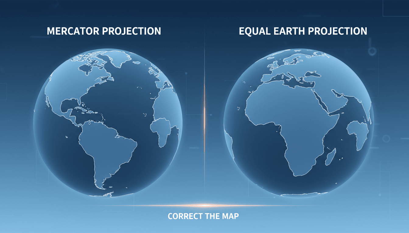
Here's what it means for you.
You may soon see changes in educational materials and digital platforms that reflect Africa's true size, impacting global perceptions.
Why it matters
This resolution addresses long-standing cartographic biases that influence geopolitical perceptions and educational content worldwide.
What happened (in 30 seconds)
- The UN General Assembly voted on 4 September 2026 to endorse the 'Correct the Map' resolution, promoting the Equal Earth projection.
- The resolution passed with 164 votes in favor, one against from the United States, and six abstentions.
- It encourages the adoption of equal-area maps to correct distortions in the Mercator projection, particularly regarding Africa's size.
The context you actually need
- The Mercator projection, developed in 1569, distorts landmass sizes, exaggerating areas farther from the equator, leading to misconceptions about Africa's scale.
- The Equal Earth projection, introduced in 2018, offers an equal-area alternative that accurately represents land sizes, gaining traction through advocacy campaigns.
- The African Union formally endorsed the Equal Earth projection in February 2026, framing the issue as one of representational equity amid historical biases in mapping.
What's really happening
The endorsement of the Equal Earth projection by the UN General Assembly marks a significant shift in how global mapping is approached, particularly concerning Africa. Historically, the Mercator projection has been the dominant mapping standard, primarily due to its navigational utility. However, its inherent distortions have led to a skewed perception of geographical realities, particularly for equatorial regions like Africa. For instance, Africa is approximately 14 times larger than Greenland, yet the Mercator projection makes them appear comparable in size.
The 'Correct the Map' resolution, sponsored by Togo and supported by numerous African nations, aims to rectify these misconceptions by promoting the Equal Earth projection. This initiative is not merely about aesthetics; it addresses deeper issues of cognitive justice and representational equity. By encouraging the adoption of equal-area maps, the resolution seeks to reshape how people perceive Africa's geopolitical significance and its role in global affairs.
The resolution is non-binding, meaning that while it encourages the replacement of Mercator maps with the Equal Earth projection, it does not mandate it. This voluntary approach allows countries to transition at their own pace, which could lead to varied adoption rates. France has already announced plans to abandon the Mercator projection in its official representations, setting a precedent that may influence other nations.
Advocacy groups like #CorrectTheMap and Africa No Filter have played a crucial role in raising awareness about the biases inherent in traditional mapping practices. Their efforts have framed the conversation around mapping as one of equity and justice, emphasizing the need for accurate representations that reflect the true scale of continents. This shift in narrative is essential for fostering a more accurate understanding of global geography, which can influence everything from educational curricula to international relations.
As educational institutions and organizations begin to adopt the Equal Earth projection, the implications for how Africa is perceived on the global stage could be profound. This change may lead to a reevaluation of Africa's role in international discussions, trade, and diplomacy, as accurate representations foster a more informed understanding of the continent's size and significance.
Who feels it first (and how)
- Educators: Schools may update curricula and teaching materials to reflect the new mapping standards.
- Geographers and cartographers: Professionals in these fields will need to adapt their practices to incorporate the Equal Earth projection.
- Media organizations: News outlets may revise how they depict geographical information, influencing public perception.
- International businesses: Companies operating in or with Africa may reassess market strategies based on a more accurate understanding of the continent's scale.
What to watch next
- Adoption rates of the Equal Earth projection: Monitoring how quickly countries and organizations transition to this new mapping standard will indicate its impact.
- Changes in educational materials: Look for updates in textbooks and digital platforms that reflect accurate geographical representations.
- International discourse on Africa: Observe shifts in how Africa is discussed in global forums, potentially leading to changes in trade and diplomatic relations.
The resolution passed with significant support, indicating a global acknowledgment of cartographic bias.
Countries will begin to adopt the Equal Earth projection, particularly those in the African Union.
The long-term impact on international relations and perceptions of Africa's geopolitical importance remains to be seen.
Frequently Asked Questions
- Why it matters?
- This resolution addresses long-standing cartographic biases that influence geopolitical perceptions and educational content worldwide.
- What happened (in 30 seconds)?
- The UN General Assembly voted on 4 September 2026 to endorse the 'Correct the Map' resolution, promoting the Equal Earth projection. The resolution passed with 164 votes in favor, one against from the United States, and six abstentions. It encourages the adoption of equal-area maps to correct distortions in the Mercator projection, particularly regarding Africa's size.
- What's really happening?
- The endorsement of the Equal Earth projection by the UN General Assembly marks a significant shift in how global mapping is approached, particularly concerning Africa. Historically, the Mercator projection has been the dominant mapping standard, primarily due to its navigational utility. However, its inherent distortions have led to a skewed perception of geographical realities, particularly for equatorial regions like Africa. For instance, Africa is approximately 14 times larger than Greenland,
- Who feels it first (and how)?
- Educators: Schools may update curricula and teaching materials to reflect the new mapping standards. Geographers and cartographers: Professionals in these fields will need to adapt their practices to incorporate the Equal Earth projection. Media organizations: News outlets may revise how they depict geographical information, influencing public perception. International businesses: Companies operating in or with Africa may reassess market strategies based on a more accurate understanding of
- What to watch next?
- Adoption rates of the Equal Earth projection: Monitoring how quickly countries and organizations transition to this new mapping standard will indicate its impact. Changes in educational materials: Look for updates in textbooks and digital platforms that reflect accurate geographical representations. International discourse on Africa: Observe shifts in how Africa is discussed in global forums, potentially leading to changes in trade and diplomatic relations.
International coverage of politics, culture, and current affairs.
"BBC News is widely regarded as a reputable international news organization, known for its impartial tone and public service mandate."
— A47 Editor
UN votes to adopt new world map to reflect Africa's true size
The United Nations has voted to adopt a new world map that accurately reflects Africa's true size, moving away from the historically criticized Mercator projection. This resolution, sponsored by Togo and supported by 164 nations, marks a significant ...
24/7 international news from a French perspective in multiple languages.
"France 24 is viewed as a globally focused outlet with balanced coverage and a European perspective."
— A47 Editor
UN ditches Mercator map to adopt more accurate one reflecting Africa's true size
The UN General Assembly has voted to replace the 16th-century Mercator map with a more accurate representation of the world's continents, particularly highlighting Africa's true size. This resolution, led by several African nations and co-sponsored b...
UAE-based English-language newspaper covering regional politics, economics, and global affairs.
"The National reflects Emirati policy perspectives while maintaining international editorial standards."
— A47 Editor
UN votes to adopt new map showing Africa's true size despite US opposition
The United Nations has voted to adopt a new world map that accurately represents Africa's true size, moving away from the historically criticized Mercator projection, despite opposition from the United States. This decision was made during a session ...